The Gulf Cooperation Council (GGC) region, and specifically the UAE and Saudi Arabia, is currently home to some of the most ambitious infrastructure projects on the planet. From the rapid expansion of Dubai’s road network to the vision of Riyadh 2030, the scale of development is unprecedented.
However, with rapid growth comes the complex challenge of managing urban mobility. In our recent webinar, "From Global AI to Local Impact," our CTO, Bart Adams, teamed up with Abdullah Alkhalaf from THTC, our partner in the GCC region, to explore how the combination of global AI technology and local expertise is solving these regional traffic hurdles.
Here are the key insights from our discussion on navigating the future of mobility in the GCC.
The Scale of the Challenge: Growth at an Accelerated Rate
The GCC isn't just growing; it's transforming. To put the pace of development into perspective, Dubai has built roughly 18,000 kilometers of roads in just four decades. This "build-it-fast" reality has led to unique pressures:
- Capacity Overload: Major arteries, such as Riyadh’s King Fahad Road, are frequently operating at 300% of their intended capacity.
- The Mega-Event Roadmap: With the Riyadh Expo 2030 and the 2034 World Cup on the horizon, the region is under immense pressure to optimize traffic flow for millions of visitors.
- Data Fragmentation: Engineers often struggle with a lack of unified data. Managing multiple authorities and diverse data providers remains one of the biggest bottlenecks in regional urban planning.
Bridging the Gap with No-Code Big Data Analytics
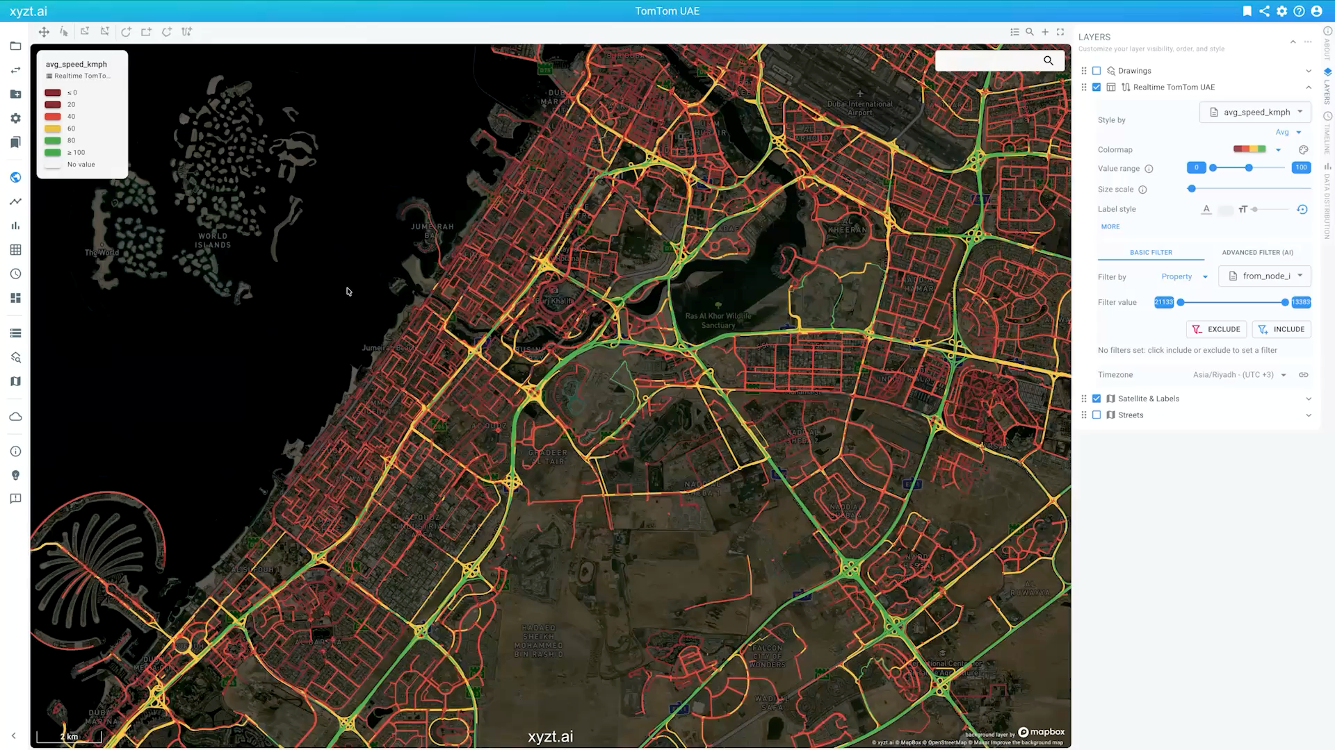
Managing billions of location data points shouldn't require a degree in data science. This is where the xyzt.ai platform changes the game for traffic engineers. By providing a no-code, SaaS environment, it allows users to move from raw data to visual insights in minutes.
The platform is built on the "XYZT" framework:
- XYZ: The spatial dimensions that map out our cities.
- T: The critical element of time, allowing engineers to compare "before and after" scenarios or analyze peak-hour trends.
By layering datasets from providers like TomTom or INRIX, engineers can visualize congestion patterns, evaluate the impact of new road closures, and perform deep-dive safety analyses without writing a single line of code.
Interested in the full webinar? Download the recording here.
Local Expertise: Turning Global Data into Regional Impact
Data is only as good as the context it lives in. In the GCC, THTC (Traffic High Technology Consultants) has spent over 26 years translating global data into local success stories. As an official partner with TomTom, THTC has developed specialized solutions tailored to the region’s most high-stakes moments:
- Hajj Season Dashboards: Real-time monitoring for one of the world’s largest annual human migrations, ensuring safe and efficient pilgrim movement.
- Major Sporting Events: During the World Cup and Asian Cup, specialized dashboards were deployed to manage the complex logistics of VIPs, referees, and national teams.
- National Day Celebrations: Using integrated camera feeds and floating vehicle data (FVD) to manage the massive influx of celebratory traffic and prevent gridlock.
The Next Frontier: "just ask" Your Data with Generative AI
One of the most exciting developments discussed was the integration of Generative AI into the xyzt.ai platform. We are moving toward a future where "talking" to your data is the norm.
With the "just ask" feature, engineers can use natural language to query complex datasets. Instead of manually filtering for "exit 10" during a specific timeframe, you can simply ask: "Show me the traffic flow through this exit during the road closure yesterday." Furthermore, AI Agents now act as thinking partners. These LLM-powered agents can analyze project attributes, explain data anomalies, and even generate interactive trend plots based on simple text prompts. This shifts the engineer's role from "data processor" to "strategic decision-maker."
Looking Ahead: A Multi-Source Ecosystem
The consensus from our session was clear: the future of smart cities in the Middle East depends on data fusion. Traffic engineers are no longer looking for a single data source; they need a way to combine floating vehicle data (FVD) with static traffic counts and IoT sensors to build a 360-degree view of the city.
As Saudi Arabia and the UAE continue to redefine the limits of urban design, the combination of xyzt.ai’s powerful analytics and THTC’s regional mastery provides the roadmap for a safer, more efficient future.
Q&A
What were the main takeaways from the webinar?
1. GCC mobility is urgent and complex
2. Global AI becomes local impact through delivery
3. Clear differentiation for fast operational use
How does no-code analytics help GCC traffic planners?
- Directly work with floating car and trips data, handling billions of records and still maintain interactive update rates, looking at traffic over global regions as well as over longer periods.
- Next to to querying, filtering, and visualizing the data, the platform provides advanced analytics capabilities such as corridor analytics and origin-destination analytics.
- Answer questions in seconds instead of having to build complex algorithms and data pipelines. Simply drag and drop your data and get started in minutes.
- Share your insights immediately and answer difficult mobility and road safety questions on-the-spot.
Ready to see how to get these insights with any data? Reach out to us to schedule a demo of our big data analytics platform.
You might also like
How AI is Reshaping Spatio-Temporal Analytics for Traffic & Maritime